
Conventional total stations and fixed laser scanners fall short in confined underground spaces—limited efficiency, sparse data density, and above all, serious safety risks when personnel must enter hazardous areas like mined-out stopes, ore passes, and blast faces. BLSS-FL changes the game.
A drone built for the dark, tight, GNSS-denied underground
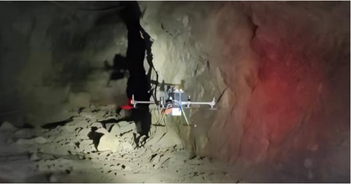
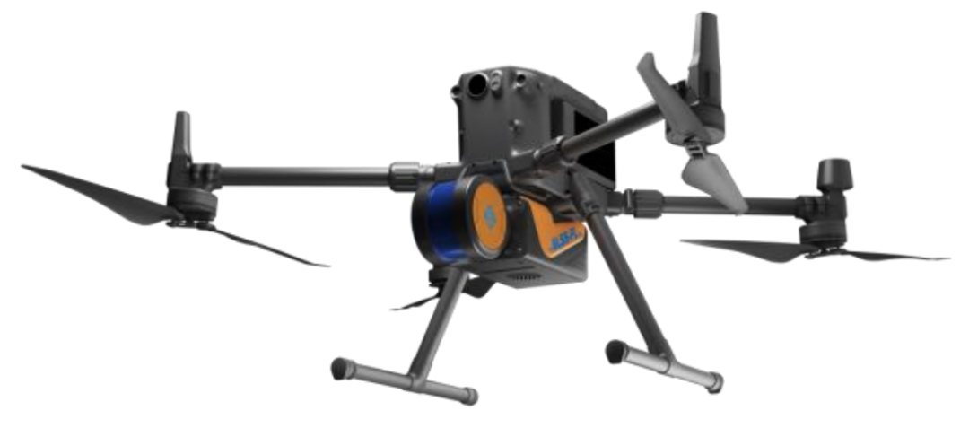
BLSS-FL integrates multi-line LiDAR and a high-precision IMU with mature SLAM algorithms, enabling autonomous positioning and mapping without any satellite signal. It flies safely in areas too dangerous for personnel, capturing real-time 3D point cloud data along with flight trajectory.
How it works – four pillars
GNSS-free SLAM positioning & mapping – Fuses LiDAR and IMU data for real-time high-precision localization and 3D map construction. Absolute accuracy: ±4 cm. Sampling rate: 300,000 points/second.
Omnidirectional dynamic obstacle avoidance – Detects obstacles as small as 1 cm diameter (rock bolts, cables, etc.), ensuring safe flight in narrow, cluttered stopes and ore passes.
Long-range communication – Up to 8 km line-of-sight, meeting deep mine drift survey needs. Supports real-time and post-processing modes.
Lightweight & rugged – Scanner weighs only 1.78 kg. IP54 rated for high humidity and dust. Class 1 laser (eye-safe).
Key performance
· ±4 cm mapping accuracy – supports quantitative evaluation of overbreak/underbreak, ore dilution and loss analysis
· 8 km communication range + omnidirectional obstacle avoidance – reaches areas inaccessible by conventional methods, eliminating personnel safety risks at the source
Applications beyond stope scanning
· Tunnel acceptance surveys
· Resource/reserve estimation
· Tailings dam drainage tunnel inspections
· Post-disaster emergency surveying
· Automated inventory of enclosed stockpiles
Deployed at multiple top-tier mines and validated across diverse geological conditions and operational scenarios. A practical, proven solution for safer, smarter underground surveying.


 Home
Home